Acreage
39
Price
$15,900
State
Arizona
Contact Information
Interested in this listing? Contact the seller for more information:
| Simple Land Deals | 480-788-9315 | Email Seller |
Property Details
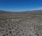
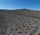
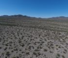
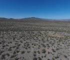
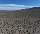
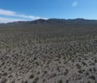
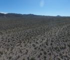
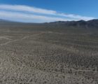
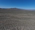
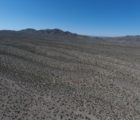
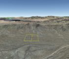
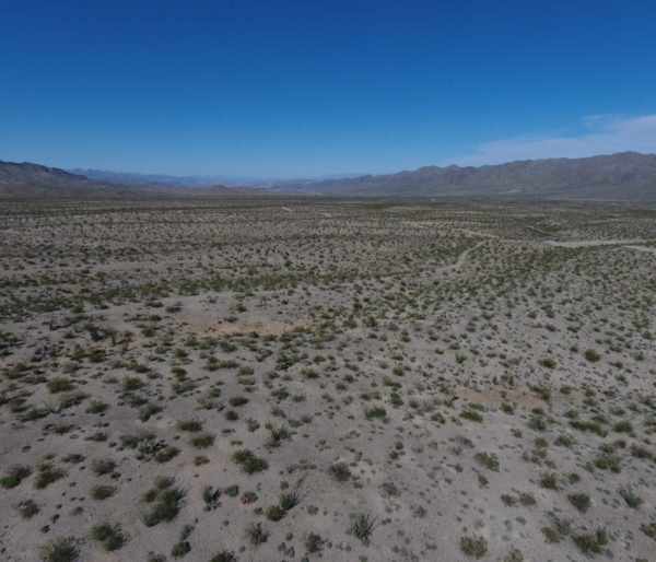
LAND FOR SALE. Nearly 40 Acres of Freedom and Adventure with Dirt Road Access into the area. Adjacent to TWO MILES of BLM Public Land to the West and South of the Property. Beautiful Mountain Views in Northern Arizona. Escape to your own Private Land – Wide Open Space – Discover outdoor activities and Explore Mohave County, Arizona and surrounding areas!
INVESTORS NOTE: Property is located about 10 miles south of the Lake Mead National Recreation Area. Three parcels available with nearly 40 acres (+/-). Prefer to sell all three parcels together, and price reflects discounted cash sale for a three parcel package deal. Will consider selling parcels separately a higher total price.
CLICK HERE – TO SEE OUTDOOR RECREATION AVAILABLE ON THE BLM FEDERAL PUBLIC LANDS – GET OUTSIDE!
OUTDOOR ADVENTURE – GO-SEE-DO
Lake Mohave – Lake Havasu – Lake Mead Recreation – Grand Canyon National Park – Colorado River – US Route 66 Adventure
All within Mohave County, you will find, Wildlife Refuges, National Parks and Forests, Rock Climb the nearby Mountain Preserves, hit the Trails for Hiking, Biking, and Horseback Riding, or go Camping, enjoy Outdoor Fun with RV / UTV / ATVs, and 4x4s. Visit the Colorado River, and go enjoy the major Lakes for Boating, Fishing, Swimming, Kayaking and Jet Ski fun — Get Outside!
NEARBY CITIES and TOWNS to Explore – Kingman, AZ – Dolan Springs, AZ, Whitehills, AZ, Meadview, AZ, Prescott, AZ – Sedona, AZ – Flagstaff, AZ – Laughlin, NV – Las Vegas, NV
*** SOLD ***
CASH SALE PRICE: $15,900 (47% Discount)
REGULAR PRICE: $30,000
See the How It Works page on our website – Finance Options Available
Ask about our Short Term Purchase Programs – Get 90 days Same As Cash Discounts – Keep it Simple!
TO BUY NOW – CONTACT TROY
PHONE: 480.788.9315
EMAIL: Troy@SimpleLandDeals.com
Facebook.com/SimpleLandDeals
@SimpleLandDeals #SimpleLandDeals
Please Add your Email to our VIP Buyers List
Sign-up to Receive Updates on New Land Deals!
PROPERTY LOCATION (Select View Map Above)
GPS Coordinates (Estimated)
APN 337-12-042 – Center Point: 35.881803, -114.263209
APN 337-12-120 – Center Point: 35.881803, -114.261540
APN 337-12-119 – Center Point: 35.881803, -114.260431
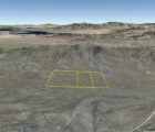
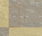
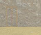
Three Adjacent Parcels just South of the Lake Mead National Recreation Area
ROADS/ACCESS: Best approach the property will be through one of the vacant land subdivisions with existing bladed dirt roads located about 2-3 miles to the East of the property. From Hideout Rd (139) turn West onto Gladiola Dr and then turn North onto Gateway Dr and connect with Gold Basin Road and head West to the property area. Dirt Roads and two-track roads run through the North end and West side of the property. See map location. Buyer to verify access – high clearance or 4×4 vehicle recommended.
PROPERTY DETAILS
LOT SIZE: 39.91 Acres (+/-)
APN: Three Adjacent Parcels: 337-12-042 (19.95 acres) and 337-12-119 (9.98 acres) and 337-12-120 (9.98 acres)
GENERAL ELEVATION (FT): 3361 (Center Point)
TYPE OF TERRAIN: Flat to Gentle Rolling Hills
ZONING: Vacant Land / Rural / AR-36A / Agricultural or Residential
POWER: Solar, Wind or Alternative System
PHONE: Mobile or Satellite or Alternative System
WATER: Drill Well, Bulk Water Delivery, Water Catchment or Alternative System.
TIME LIMIT TO BUILD: None
PROPERTY TAXES: Paid Current, approximately $176.10 (+/-) per year for all three parcels
HOA/POA DUES: None
CLOSING COSTS: Buyer pays all closing costs (Approximately $800, which includes Title Insurance and Escrow Fees)
DOCUMENT FEES: $0.00 (With Direct Close)
CONVEYANCE DOCUMENT: Special Warranty Deed
TITLE INFORMATION: Clear
DESCRIPTION (abbreviated): T29N R18W SEC 19 W2 SW4 SW4 CONT 19.95 ACRES and T29N R18W SEC 19 W2 E2 SW4 SW4 CONT 9.98 ACRES and T29N R18W SEC 19 E2 E2 SW4 SW4 CONT 9.98 ACRES
PROPERTY INFORMATION: Buyer is responsible for their own due diligence and review of the property. All information, videos, images, measurements, distances, and gps location coordinates are estimated for general reference and illustration purposes.
PHOTOGRAPHY: Photography displayed on this website is for general reference. We provide pictures of the parcel when available; otherwise, we do our best to illustrate the local topography within the designated county area.
DISCLOSURE: SimpleLandDeals.com, its owners, partners, members, managers, trustees, employees or affiliates hold one or more professional licenses in the Real Estate, Mortgage or Insurance industries; and does not represent anyone except themselves as a principal in the property transaction. NO brokerage or agent commission shall be due or paid to us for this transaction.


